Blog
The Swansea Blitz
This aerial photograph (see Catherine's post about the Swansea Council meeting), which can also be found under the timeline feature of Google Earth, shows the areas (light grey) that were destroyed during the blitz of February 1941.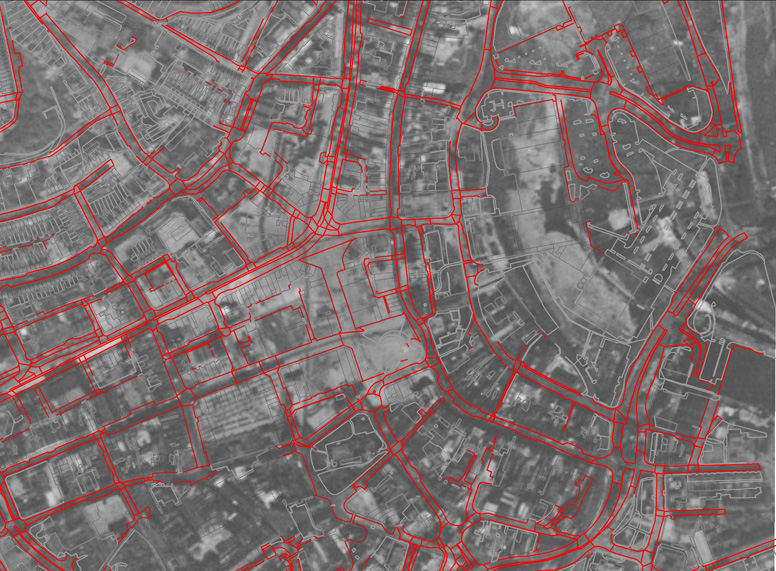
The red lines are the modern streets and the grey lines modern buildings. The bombing of Swansea resulted in the loss of many historic buildngs, and the post-war rebuilding resulted in the creation of a new street pattern in some areas of the city.
(see http://ididitthisway.wordpress.com/tag/blitz/ and http://education.gtj.org.uk/en/themeitems/28891 for some striking photographs of the impact of the blitz on Swansea).
The changes to the street pattern in the period after the Second World War add to the challenge of recreating the street pattern of the medieval city. The analysis of the topogaphy of Swansea works on the principle of using modern maps and overlaying older maps to ide.jpgy changes to the streets and property boundaries to determine the earliest elements of the town plan within the GIS as discussed in earlier posts. This relies on having common features in the modern town plan that can be related to features on earlier maps. This is known as map regression and forms part of a processes called urban morphology and plan analysis.
Share on Twitter Share on Facebook